Layer Concept #
Geoinformation systems (GIS) visualize data by stacking layers on top of one another to create maps. Every layer represents one set of information. This is a vital concept to understand since analysis, as well as visualisation of data, is based on it.
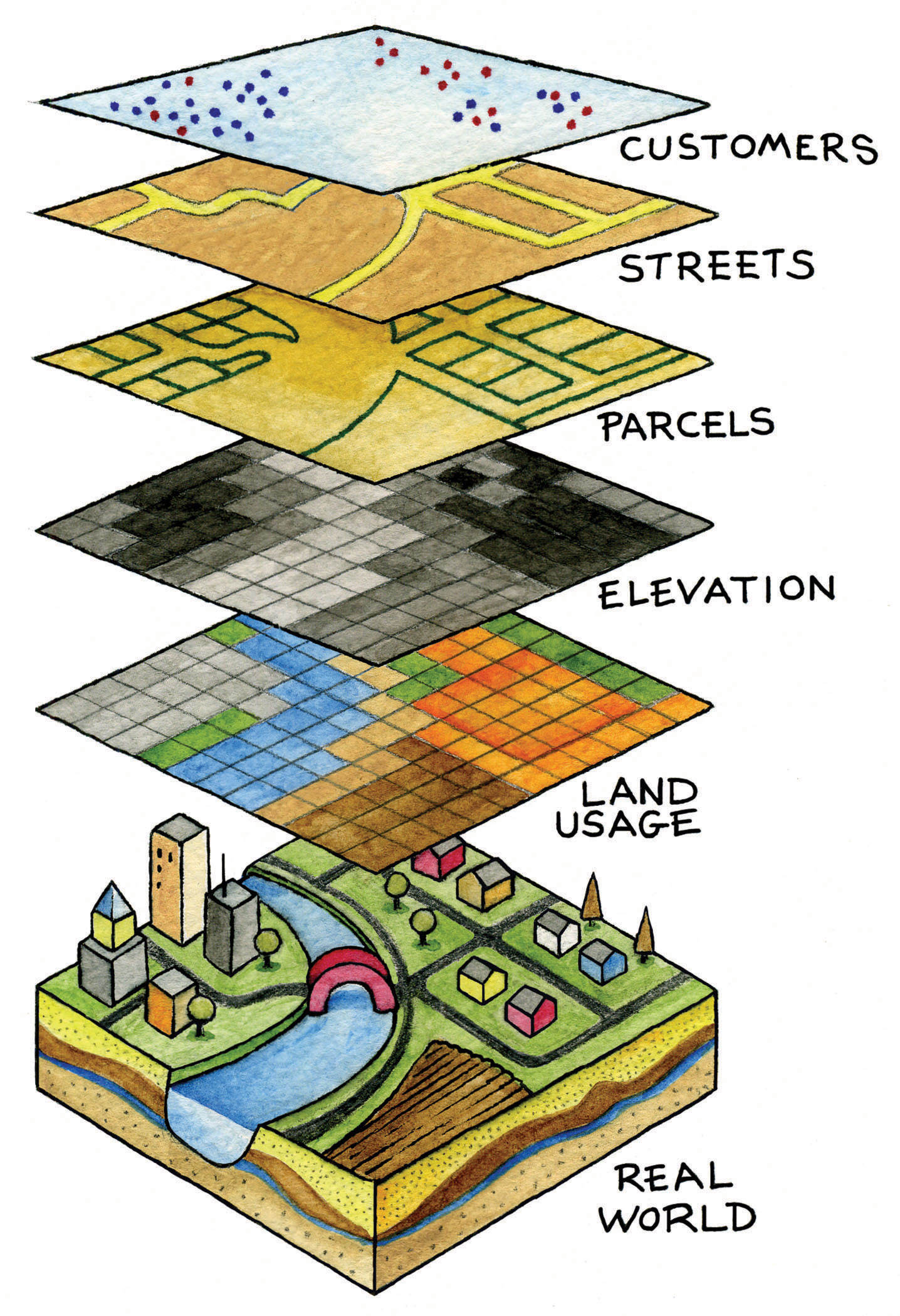
Fig. 12 The layer concept in GIS applications. Source unknown. All rights reserved. This content is excluded from our Creative Commons license.#
Hide and show layers #
Check the check-box in the Layers panel on the bottom left:
Have you “lost” your layer? #
Right click on your layer → Zoom to layer(s).
Move layers in the hierarchy #
Move a layer up and down in the Layer panel by drag-and-drop.
Move a layer to the top: Right click on your layer →
Move To Top.
Change Layer Name #
Right click on your layer → Rename Layer.
Layer properties #
Each layer has additional properties that you can view and customise. The most important are:
Information: An overview of the layer name, file format, storage location, spatial extent, number of features (objects),…
Symbology: Display mode of the layer, style, transparency,…