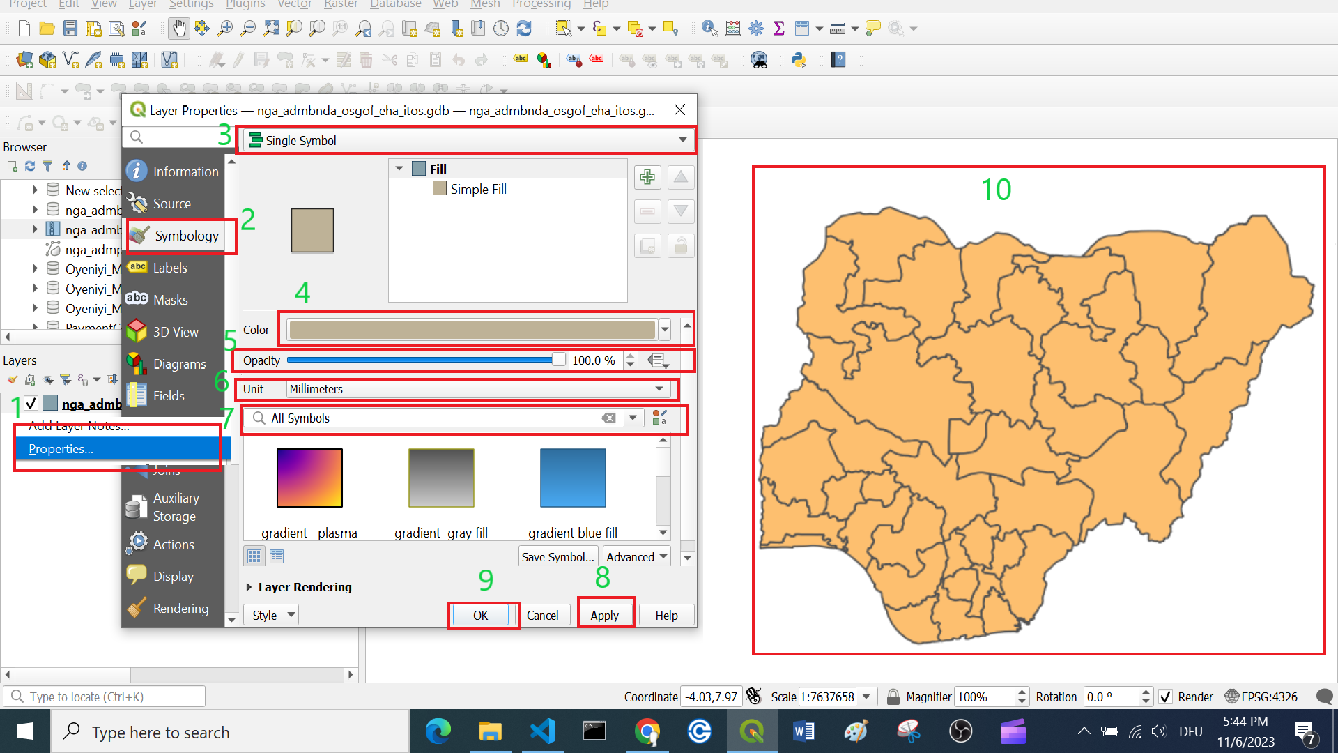
Single symbol classification #
By default, QGIS visualizes all layers in the
Single symbolsetting.This means all the features of a layer are visualised the same.
In this setting, you can change many parameters like colour or opacity but you can’t classify any data!
To adjust the style of a layer…
Right-click on your layer.
Click on
Symbology.Confirm that the layer setting is on
Single Symbol.Select the colour of your choice in the drop-down menu. For more colour options select in the drop-down menu
Choose Color.Optional: You can adjust the opacity/ transparency of the layer. This can be very useful when you want to show multiple overlapping layers.
Optional: Here you can set the unit type. This is useful when you want to, for example, visualise points in a certain size.
Optional. Here you can find standard and previously used styles quickly.
Click
Applyto put your adjustment into effect.Click
OKto close the window.