Categorized classification#
Categorized classification in QGIS groups spatial data into distinct categories based on specific attributes. This classification enhances the organization and interpretation of geospatial information for clearer insights.
Categorized classification is usually used for nominal and ordinal scaled data.
Data Scale |
Definition |
Example |
Typical Data Format |
|---|---|---|---|
Nominal Scale |
Categories without inherent order or ranking |
Land cover types, districts, livelihood zones |
Text (“Desert”) or Integer (5) |
Ordinal Scale |
Categories with a meaningful order or ranking |
Ranks (e.g., low, medium) |
Text (“high”) or Integer (5) |
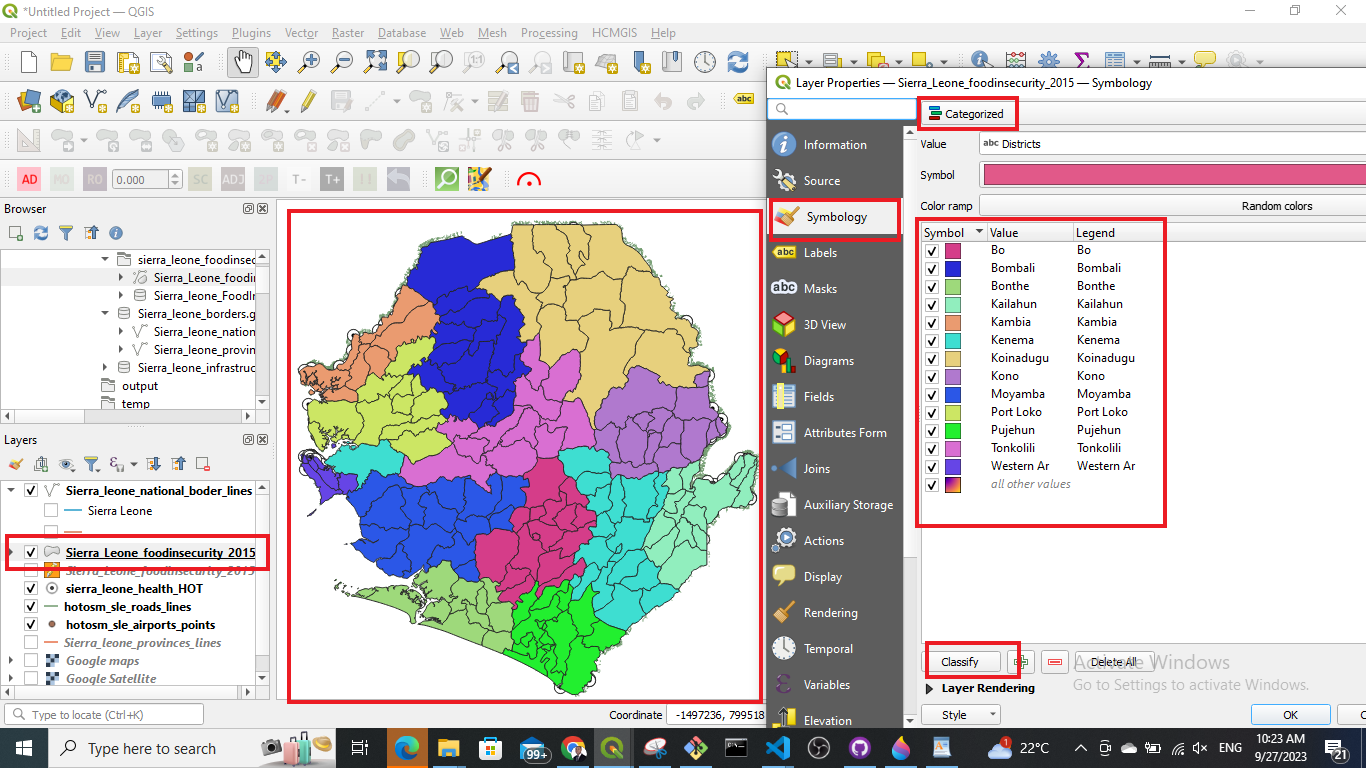
To classify data in categories…
Right-click on your layer
Click on
SymbologyClick on
CategorizedIn the
Valuedropdown menu select the column based on which you want to categorize your data.Further down the window click on
Classify. Now you should see all unique values or attributes of the selected column inValue. To add or delete single values use the-and+buttons.Optional: In the
Symboldropdown menu you can select the colours and symbols you want to useOptional: In the
Color rampdropdown menu you can specify the range of colours you want to useOptional: You can open the panel
Layer Renderingon the button of the window. Here you can adjust the opacity/ transparency of the layer.Click
Applyto put your adjustment into effect.Click
OKto close the window.